Click for price
Affordable software for Land Surveyors
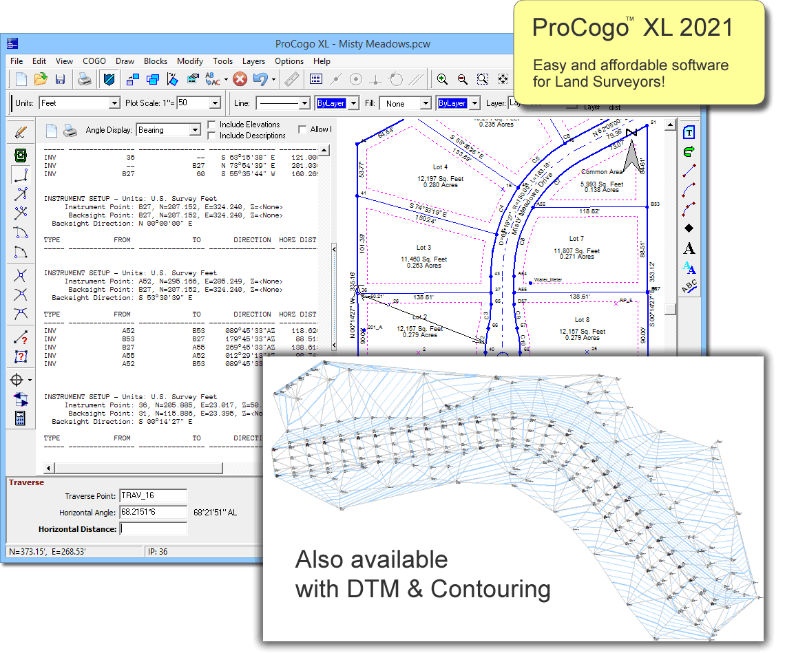
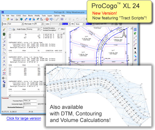
Easy, straightforward COGO, CAD, Data Collection and Legal Description Writer for Land Surveyors. COGO calculations and linework are both displayed while you work. Draw linework as you traverse and inverse, or use the regular drawing tools to draw linework wherever you wish. Create your own custom symbols (blocks) as well as add text including paragraph text, text along an arc, and curve tables. Print your drawing at any scale and rotation, or export it to DXF to be imported into AutoCAD. Quickly create legal descriptions from your lots with the ProCogo XL version of Legal-Aid that is included. ProCogo XL is available both with and without DTM & contouring.
Click here for a guided tour of features.
Highlights
- Easy to use Coordinate Geometry and survey calculations
- Create legal descriptions from parcels in the drawing.
- Create a Digital Terrain Model and then create and label contours from it (DTM version only)
- Calculate volume of a spoil pile or borrow pit.
- Import and process data collector files.
- COGO points and linework are all stored in one, single drawing. No need to link to external COGO files or databases.
- Over 30 new linetypes.
- Alpha-numeric point names.
- Bearing and distance recall.
- Bearing and distance annotations including custom annotation configurations.
- Pick COGO points right from the screen, or call them up by name.
|
- Draw lines, arcs, tracts (polylines).
- Draw text including paragraph text and text along an arc.
- Create custom blocks (symbols) and share them with everyone else on your network.
- Automatically subdivide a parcel into equal parts, or into specific sizes by area.
- Automatically draw a deed from the text of a legal description.
- Import aerials and scanned maps to draw over or use as a background or location map.
- Impoort linework from shape files.
|