
ProCogo XL with TOPO
Includes everything in our ProCogo XL software plus DTM, Contours and Volume calculations.
Easily create surface models for contours and volume calculations.
- Fast TIN generation (50,000 points in 10 seconds).
- Add break lines to define features such as top of bank or bottom of swale.
- Create major and minor contour lines.
- Easily create contour labels.
- Apply contour smoothing (adjustable).
- Create spot elevations
- Create cut & fill spot elevations on volume surfaces
- Calculate the volume between two surfaces
Learn More....
- Click to learn about TOPO features.
- Click to learn about ProCogo XL standard features.
 Click for large version
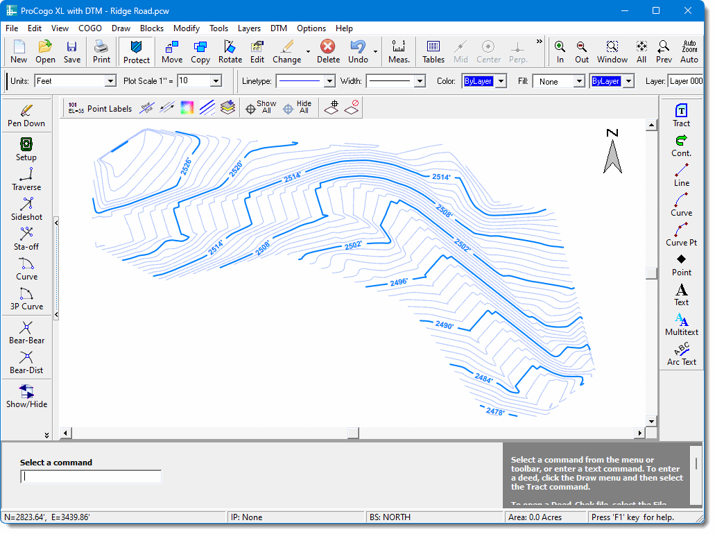
Automatic Contours
Contours are created automatically from the surface model by simply specifying the desired major and minor contour intervals. You can specify the line type, color, and label style for both major and minor contour lines. The entire process can be done in seconds. And if you need to change anything, the contours are automatically regenerated with the new changes applied.
Volume Calculations
Compare two surfaces to calculate the volume difference between them. The first surface might be natural ground and the second could be same area after a spoil pile or borrow bit has been created. Place a border around the area to restrict the calculations to just the portion that you are interested in.
The 3D Surface Model
A “surface” is created from 3D COGO points. These are typically shots taken in the field or x, y, z points imported into the program. A triangulated irregular network (TIN) is then quickly calculated from the points, and break lines can be added to help define features where the slope changes such as a top of bank or center of swale. This 3D surface is called a “Digital Terrain Model”, or DTM.