
ProCogo XL - Affordable Software for Land Surveyors
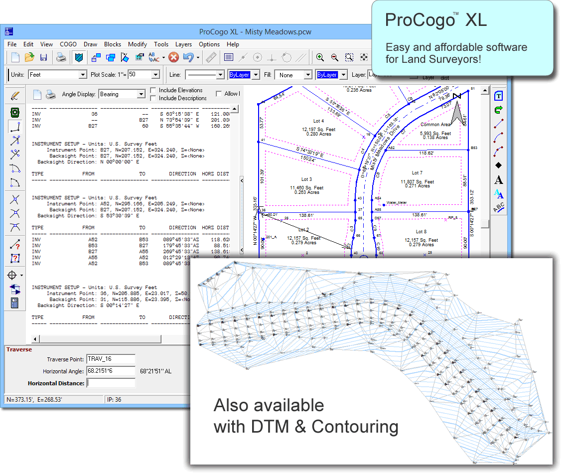
ProCogo XL includes Coordinate Geometry, TOPO, DTM, Contour Mapping, Data Collection, Legal-Writer, Volumes and Plot as you go.
With ProCogo XL, you can do....
- Survey control
- Boundary surveys
- Mortgage surveys
- Topographical Surveys
- Contouring
- Construction stakeout
- Subdivision design
- Volume calculations
- Legal descriptions
- Subdivision layout
- Locations, closures and more
Easy, straightforward surveying software. Includes coordinate geometry, CAD, data collection, and a legal description writer. Also available with contouring and volume calculations.
Includes a free copy of our RPN and Curve calculator software. Click to learn more
Highlights
- Easy to use Coordinate Geometry and survey calculations
- Create legal descriptions from parcels in the drawing.
- Create a Digital Terrain Model and then create and label contours from it (DTM version only)
- Calculate volume of a spoil pile or borrow pit.
- Import and process data collector files.
- COGO points and line work are all stored in one single drawing. No need to link to external COGO files or databases.
- Over 30 new line-types.
- Alpha-numeric point names.
- Bearing and distance recall.
- Bearing and distance annotations including custom annotation configurations.
- Pick COGO points right from the screen, or call them up by name.
- Draw lines, arcs, tracts (polylines).
- Draw text including paragraph text and text along an arc.
- Create custom blocks (symbols) and share them with everyone else on your network.
- Automatically subdivide a parcel into equal parts, or into specific sizes by area.
- Automatically draw a deed from the text of a legal description.
- Import aerials and scanned maps to draw over or use as a background or location map.
- Import line-work from shape files.