|
||
|
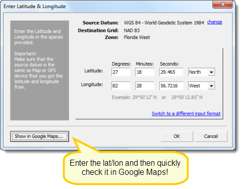
Latitude and longitude can be used for nearly all CAD and COGO commands. For instance, you can use the line command to draw from one lat/lon value to another. You can also plot the lat/lon entry in Google Maps for a quick check of its location.
Source datums include WGS 84, WGS 72 and NAD83. Destination coordinate systems include UTM North, UTM South and NAD 83 State Plane Coordinates.
|
||
|